Contents
The course will provide advanced scientific knowlenge on theory and applications of land remote sensing. It will be organized around five main components:
- Presentation of the Sentinel-1, -2 and -3 missions;
- Theoretical fundamentals of spaceborne Optical, Thermal and SAR remote sensing;
- EO land applications lectures on Land Use and Land Cover, Change Detection, Terrain Motion, Hazards, Forest Bio-physical retrievals, Multi-temporal analysis, Flood monitoring, Snow Cover mapping, Climate (Water and Carbon);
- Practicals using ESA toolboxes for scientific exploitation of EO data;
- EO data processing and product demonstration for land resources monitoring.
The training course will include formal lectures by leading scientists as well as hands-on computing exercises exploiting real and simulated data for science and application.
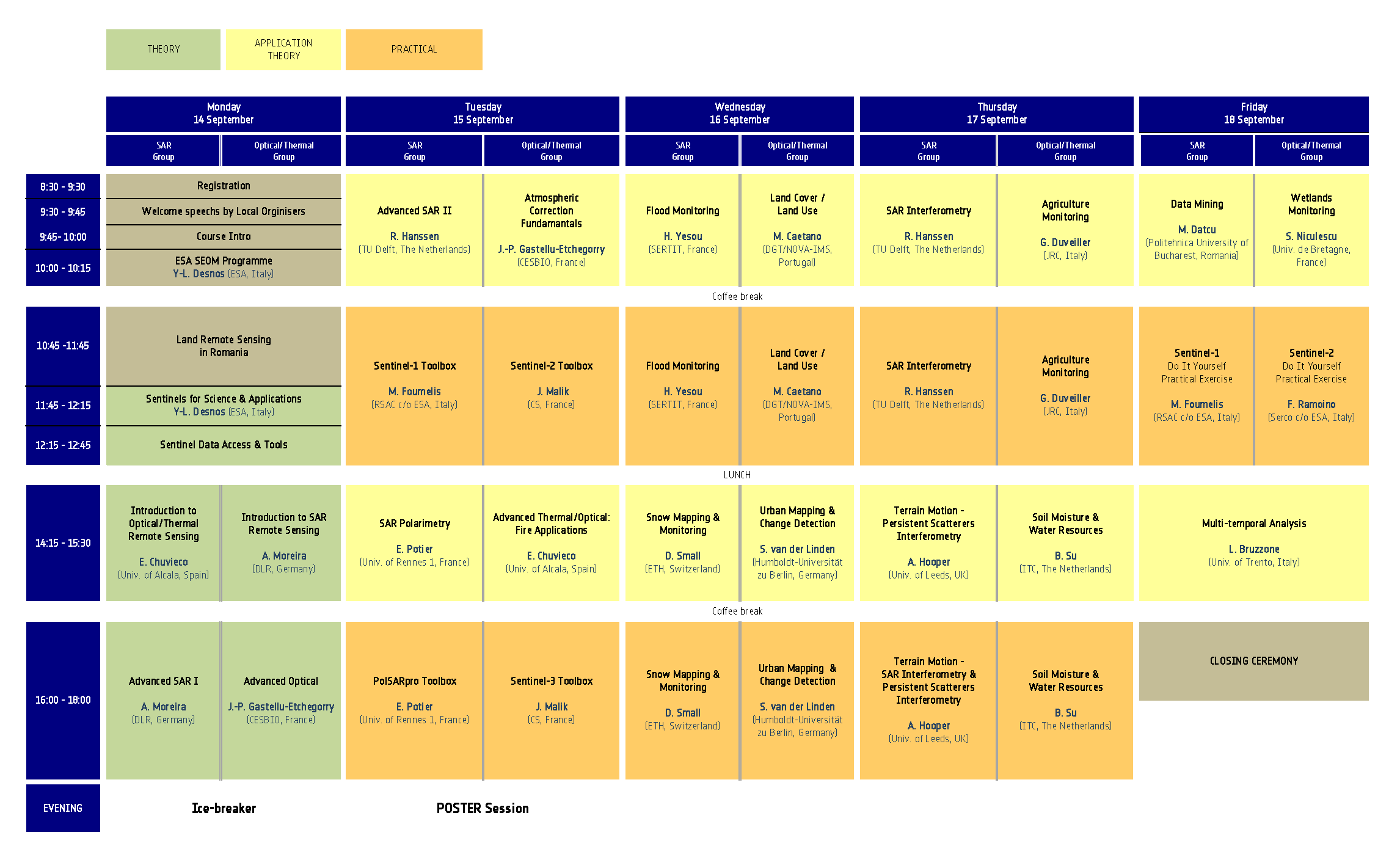
Overview Programme
An overview programme of the course is available below.
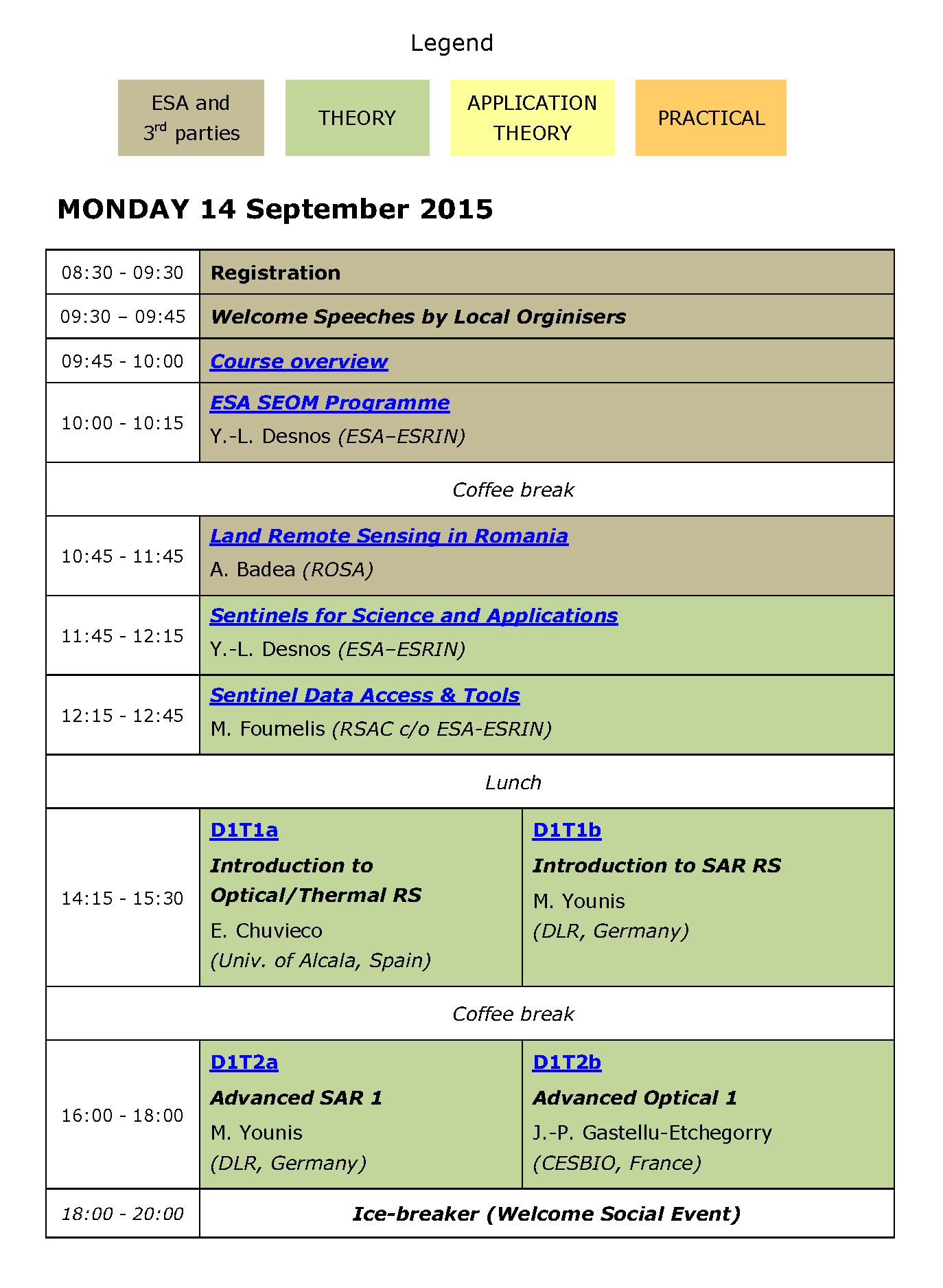
Daily Programme & Materials
The daily programme of the course, including links to presented materials, is available below.


