The BIOMASS Mission
2015-01-29 09:00 - 2015-01-29 10:40
Chair: Thuy Le Toan, CESBIO
-
10:20 On the Correlation Between Biomass and the P-band, Polarimetric HH-VV Phase Difference, and Its Potential for Biomass and Tree Number Density Estimation from SAR
Soja, Maciej Jerzy (1); Blomberg, Erik (1); Ulander, Lars (1,2) 1: Chalmers University of Technology, Sweden; 2: Swedish Defence Research Agency
Show abstract
In May 2013, the BIOMASS mission was selected by ESA to become the first P-band SAR in space, with the main goal to map the global forest resources in terms of biomass, biomass change, and forest height. During the BIOMASS feasibility study, the estimation of these parameters was studied using airborne SAR data acquired within the BioSAR and TropiSAR campaigns, conducted in the boreal forests of Sweden and tropical forests of French Guiana, respectively [1-4]. In the boreal forest, it has been shown that biomass can be estimated with good accuracy from P-band SAR intensity data using a regression model based on the HV-polarised scattering coefficient, the HH/VV-ratio, and the ground slope angle [3, 5]. Moreover, the same model parameters can be used in both Remningstorp and Krycklan, which are the two Swedish test sites separated by 720 km and featuring different types of forest. With model parameters estimated in Krycklan, biomass could be estimated in Remningstorp with a root-mean-square error of 22-33%. However, a decreased performance was observed for a forest with significant understorey vegetation, which caused an increased cross-polarised backscatter, without significantly contributing to the total biomass. During a parallel study aiming at the development of a forward model for the BIOMASS End-to-End Simulator (BEES), a significant correlation between the polarimetric, HH-VV phase difference and biomass was observed for the boreal test site of Remningstorp (R2≈0.62), and the observed correlation was not affected by the understorey vegetation that caused problems in the backscatter-based biomass estimation [5, 6]. The polarimetric, HH-VV phase difference is related to the effective penetration depth difference between the HH- and VV-channels. For the P-band SAR data acquired over Remningstorp, the HH-VV phase difference changes with approximately 80° when biomass increases from 0 to 300 tons per hectare. This means that the penetration depth difference between the HH- and VV-channels changes with roughly 19 cm when biomass increases from 0 to 300 tons per hectare. This leads to the conclusion that the forest in Remningstorp can be seen as a polarizing filter, making the penetration depth polarization-dependent. If the previously mentioned understorey vegetation consists of more randomly oriented scatterers than the forest above it, the HV-backscatter will be increased, which will cause the HV-based biomass estimation algorithm to overestimate biomass, as it is observed for one region in [3]. At the same time, the effective attenuation of both co-polarised channels will be similar, and the correlation of the HH-VV phase difference with biomass will be unaffected, as it can be deduced for the same region in the figures in [5]. It is motivated to study the polarimetric, HH-VV phase difference for its potential for forest parameter estimation. It is reasonable to believe that not only biomass, but the tree number density, which is also an important forest parameter [7], can be estimated from the polarimetric phase difference. As the influence of topographic variations has been shown significant at P-band, and the HH-VV phase difference is expected to be less susceptible to topography, it is also important to study the influence of topography. In this paper, the potential of the HH-VV phase difference for the estimation of both forest biomass and tree number density will be studied, in view of the future P-band BIOMASS mission. Polarimetric data from the latest BioSAR campaign, conducted in 2010 with the SETHI system over Remningstorp, will be used. The influence of surface topography on the phase difference will be examined by comparing three different acquisition headings. Biomass and tree number density data from 32 circular, 0.5-hectare forest plots will be used. Biomass maps will be created and compared to lidar-derived reference biomass maps. [1] D. H. T. Minh, T. L. Toan, F. Rocca, S. Tebaldini, M. M. d'Alessandro, and L. Villard, "Relating P-Band Synthetic Aperture Radar Tomography to Tropical Forest Biomass," IEEE Transactions on Geoscience and Remote Sensing, vol. 52, pp. 967-979, Feb 2014. [2] G. Sandberg, L. M. H. Ulander, J. Wallerman, and J. E. S. Fransson, "Measurements of Forest Biomass Change Using P-Band Synthetic Aperture Radar Backscatter," IEEE Transactions on Geoscience and Remote Sensing, vol. 52, pp. 6047-6061, 2014. [3] M. J. Soja, G. Sandberg, and L. M. H. Ulander, "Regression-Based Retrieval of Boreal Forest Biomass in Sloping Terrain using P-band SAR Backscatter Intensity Data," IEEE Transactions on Geoscience and Remote Sensing, vol. 51, pp. 2646-2665, May 2013. [4] I. Hajnsek, R. Scheiber, L. M. H. Ulander, A. Gustavsson, G. Sandberg, S. Tebaldini, et al., "BioSAR 2007 technical assistance for the development of airborne SAR and geophysical measurements during the BioSAR 2007 experiment: Final report without synthesis," ESA contract no. 20755/07/NL/CB2008. [5] M. J. Soja and L. M. H. Ulander, "Polarimetric-Interferometric Boreal Forest Scattering Model for BIOMASS End-to-End Simulator," in IEEE International Geoscience and Remote Sensing Symposium (IGARSS), Quebec City, QC, Canada, 2014, pp. 1061-1064. [6] M. J. Soja and L. M. H. Ulander, "A Hybrid Model for Interferometric and Polarimetric P-band SAR Modelling of Forests," in Proceedings of PolInSAR 2011, 2011. [7] G. Smith-Jonforsen, K. Folkesson, B. Hallberg, and L. M. H. Ulander, "Effects of Forest Biomass and Stand Consolidation on P-Band Backscatter," IEEE Transactions on Geoscience and Remote Sensing Letters, vol. 4, pp. 669-673, 2007.
-
09:00 Facing the scientific challenges of the BIOMASS mission
Quegan, Shaun University of Sheffield, United Kingdom
Show abstract
The selection of the BIOMASS mission to be ESA’s 7th Earth Explorer in May 2013 was a confirmation of the strength of the scientific case for the mission, but also signaled the need to identify and address the range of challenges that must be met before launch if we are to be fully prepared for the completely new types of data from the mission. It should be stressed how innovative BIOMASS is: it is the first P-band radar in space, the first systematic application of Pol-InSAR to recover forest height from space, and the first application of radar tomography from space. Because it is so innovative, we currently have only limited experimental data on which to base our understanding of P-band data, to characterize the properties of the different measurement modes, and to develop algorithms for recovering geophysical information from the data, all from airborne or ground-based platforms. Hence preparation for BIOMASS requires serious efforts both to acquire more data in order to address key questions, such as how sensitive the measurements are to forest type and structure, and to combine the data with physical and biophysical knowledge in order to establish general properties expected of the BIOMASS measurements. This paper sets out some of the challenges faced in pursuing this programme and progress in meeting these challenges, as described in the four sections below. Quantifying and correcting the effects of environmental variation on estimates of biomass by the BIOMASS mission: The environmental conditions under which BIOMASS will operate will vary in many aspects depending on time and location during the mission. Examples include physical process such as ionospheric variability, weather (wind and rain) and soil moisture changes, but other types of variability must also be contended with, including topography and the fact that the data acquisition pattern will cause regions that are relatively close in space to be observed far apart in time (up to several months separation). Major progress has been made in addressing these issues. Methods to correct ionospheric effects are well developed, and key insights developed from ESA airborne campaigns allowed the development of algorithms that compensate for topographic and soil moisture effects. However, validation of the latter methods is currently limited to boreal forests, largely because we do not have airborne data from varying seasons in the tropics. Indeed, the insights gained from the boreal and tropical airborne campaigns have not yet been integrated into a consistent approach to biomass estimation under changing temporal and spatial conditions. This synthesis is necessary in order to compensate for the variability imposed by the BIOMASS orbit pattern and acquisition strategy. Combining measurement modes: In at least one year of operation, BIOMASS should make global forest measurements in three separate modes: polarimetry, PolInSAR for forest height and tomography. These three types of measurements will be simultaneously available, and the challenge is how to combine them to make best estimates of forest biomass. Forest height can be combined with polarimetric estimates of biomass using a Bayesian scheme as long as we have unbiased height measurements, unbiased allometric relations between height and biomass and the polarimetric estimate is unbiased. In addition we need credible estimates of the variability on the measurements in order weight to the terms correctly in the Bayesian estimate. The challenge is therefore to characterize bias and noise sources throughout the measurement procedure, going all the way from the instrument through to the biophysics. A further challenge is to exploit the information provided from tomography to investigate the physical properties underlying the polarimetric and Pol-InSAR measurements, and to use this to optimize the inversion algorithms. Training and validation: the scale at which BIOMASS can measure biomass is strongly constrained by the available bandwidth (6 MHz) and speckle, a noise-like electromagnetic effect that cause single measurements to have high variance. In practice this means that acceptable accuracy on biomass cannot be made at scales below 200 m, and reaching this scale requires optimum methods to combine data from different polarisations and possibly different times (a challenge in itself). However, this raises several statistical and methodological questions: What ground measurements need to be made and at what scale in order to adequately train the biomass recovery algorithms and validate the recovered values? Do training and validation have different requirements? What are the implications for ground sampling design, and to what extent can we exploit measurements made at the more usual sub-hectare scales of forest measurements? The physics of scattering from forests at P-band: Closely related to training and validation is another key question: how variable are forests at the BIOMASS wavelength and how finely must we stratify the world’s forests in order to match the inversion algorithms to forest properties? It is quite clear that we cannot answer this question empirically before the BIOMASS launch, and indeed may have to learn the complete answer once the data become available. However, there are reasons to believe that the 70 cm wavelength of BIOMASS imposes a regularity that can be exploited to greatly reduce the numbers of sample plots needed. In particular, the available airborne data are striking by their adherence to a power law relating the HV backscatter and biomass. The challenge is to understand why this is, whether it is indeed a general property, how it extends to multi-polarisation data, and what controls both the power law exponent and the absolute level of the response. Addressing this challenge may require exploiting what tomography teaches us about where in a forest canopy P-band radiation scatters as a function of polarisation, and relating this to realistic biophysical models of forest canopies.
-
09:40 On the Separation of Dynamic Scattering and Ionospheric Effects in SAR Data
Kim, Jun Su; Papathanassiou, Konstantinos German Aerospace Center, Germany
Show abstract
SAR image generated by pulses that traveled twice through the ionosphere contains information on both the scattering properties of the ground and the propagation properties induced by the ionosphere. In low-frequency SAR systems, the contribution of propagation in the ionosphere becomes strong enough to bias the geo-/biophysical parameters inversion. [1] For their exact and precise inversion, the contribution of the propagation should be separated, isolated, and suppressed. This paper presents two applications for the separation of the ionospheric propagation effects from SAR data. The first is equatorial amplitude/phase stripes probably induced by the plasma bubbles elongated along the geomagnetic field. [2] Their direction and displacement in the azimuth sub-looks are closely related to the altitude and the drift of plasma bubbles [3]. In the presence of topography, these stripes are obscured and its displacement becomes difficult to be estimated. We propose a method to remove the topography-induced distortions and to estimate the ionospheric altitude and drift velocity from the direction and the displacements. ALOS PALSAR data acquired over some places of South America are used for the test of this method. These estimated values are compared with archive data provided by the ionosphere observatories in nearby locations. The second application discussed in this paper is the separation of the dynamic components of the ground motion. The cross-correlation between two SAR images is expected to provide the displacement field of the tectonic motions, glacial flows and/or mass movements. However, the ionospheric gradient also induces additional azimuth-direction shifts (ionospheric azimuth shift) on SAR data [4] hindering the extraction of pure ground motion. In this paper, the ground components from the ionospheric azimuth shifts is separated by comparing shift estimates acquired at different azimuth sub-bands. Whereas the ground motion is invariant under small change of look-direction in the synthetic aperture, the ionospheric azimuth shifts should have been translated in the azimuth direction due to the parallax effect [5]. These two components are separated in the frequency domain. This idea is validated on an inter-seismic InSAR pair of ALOS PALSAR over Kyrgyzstan. This approach can also be applied on the unwrapped interferometric phases to isolate the ionosphere-induced interferometric phase components from atmospheric, deformation, and DEM error phases. Similar approach to Faraday rotation verifies its origin at the ionospheric altitude. References [1] F. Meyer, “Performance requirements for ionospheric correction of low-frequency SAR data,” IEEE Transactions on Geoscience and Remote Sensing, vol. 49, no. 10, pp. 3694-3702, 2011. [2] M. Shimada, Y. Muraki, and Y. Otsuka, “Discovery of anomalous stripes over the Amazon by PALSAR onboard ALOS satellite,” in IGARSS2008, Boston, USA, 2008. [3] J. S. Kim and K. Papathanassiou, “SAR observation of Ionosphere Using Range/Azimuth sub-bands,” in EUSAR 2014, Berlin, Germany, 2014. [4] A. L. Gray, K. E. Mattar and G. Sofko, “Influence of Ionospheric Electron Density Fluctuations on Satellite Radar Interferometry,” Geophysical Research Letters, vol. 27, no. 10., pp. 1451-1454, May 2000. [5] J. S. Kim, Development of Ionosphere Estimation Techniques for the Correction of SAR data, Zurich: Ph. D. Dissertation, Swiss Federal Institute of Technology 2013.
-
10:00 ASSESSMENT OF TROPICAL FOREST BIOMASS: A CHALLENGING OBJECTIVE FOR THE BIOMASS MISSION
Le Toan, Thuy (1); Villard, Ludovic (1); Ho Tong Minh, Dinh (1); Koleck, Thierry (1); Dubois-Fernandez, Pascale (2); Chave, Jerome (3); Rocca, Fabio (4); Tebaldini, Stefano (4) 1: Centre d'Etudes Spatiales de la Biosphère (CESBIO),Toulouse, France; 2: ONERA, Salon de Provence, France; 3: EDB, Toulouse, France; 4: PoliMi, Milan, Italy
Show abstract
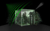
Forests have an important role in tropical countries by providing renewable resources, raw materials and energy, maintaining biological diversity, and protecting land and water resources. Globally, tropical forests hold a large fraction of the terrestrial carbon, and they thus play a major role in the global carbon cycle. When forests are cleared or degraded, the stored carbon is released to the atmosphere, and the carbon sinks are altered. Central to these carbon flux calculations is tropical forest biomass, for which existing information is poor. In situ estimation of biomass is difficult in dense forests characterized by high biomass density (up to 500 t ha-1 or greater), and there is no spaceborne sensors capable of measuring such high range of biomass. To quantify tropical forest biomass and its dynamics during the mission lifetime is therefore a major objective of the Biomass mission. To address this issue, dedicated experiments have been carried out in tropical rain forests to collect the datasets needed for the understanding of the P-band SAR measurements, in order to develop adequate biomass retrieval methods. The airborne campaigns collect P-band polarimetric (PolSAR), polarimetric-SAR Interferometry (Pol-InSAR) and SAR tomography (TomoSAR) data, together with detailed in situ and lidar data over reference forest plots. The TropiSAR campaign has been conducted in August 2009 over two main forest sites in French Guiana, and the next AfriSAR campaign will be carried out in Gabon, over the rain forests and other types of ecosystems in 2015. The tower-based experiments collect data at a short time interval and for long periods (e.g. every 15 minutes, for 1 year or more) to study the temporal variation of the radar measurements, in relation with variations in environmental conditions and in the tree physiology. The first experiment (TropiScat) was conducted in French Guiana) in 2010-2012 and the second experiment (AfriScat) is scheduled to start in November 2014 in the rain forest in Ghana. These recent experiments, together with new techniques, such as tomography, have brought new understanding of the radar scattering mechanisms in tropical forests. The gained understanding was found essential in developing biomass and height retrieval methods that are adapted to the conditions encountered in this major forest biome. The new findings can be summarized as follows: a) SAR tomography has emerged as an important tool to provide insights on the scattering mechanisms and accurate Biomass products (biomass, forest height and terrain topography). During an initial phase where system’s orbit will be adjusted to gather multiple acquisitions over the same sites, characterized by small baselines and a repeat pass time on the order of a few days, thus allowing a reconstruction of the forest vertical structure. This phase, referred to as the tomographic phase, was planned to cover a part of the world’s forest biomes, and is expected to provide useful insights for improving forest height and AGB retrieval during the rest of mission lifetime. b) Analysis of PolSAR data and their temporal changes confirmed and quantified the relative importance of the disturbing effects and helped to construct the retrieval algorithms. For tropical forest, adapted topographic correction methods are strongly required to recover the (weak) sensitivity of the backscatter to biomass. Although the environmental effects are less important in tropical forest compared to boreal forest, changes in backscatter due to diurnal and seasonal changes in tree dielectric properties also need to be account for. Data from the TropiScat experiment show a diurnal cycle of 1 dB, which can be explained by temporal variation in vegetation dielectric constant, caused by xylem sap flux variation. At the Biomass equator crossing times (6 am and 6 pm), long term measurements show temporal RMS of 0.2 dB during the dry period and 0.4 dB during rainy period. These observations, to be confirmed by the AfriScat, indicate a need to adapt retrieval algorithm to these backscatter temporal variations. c) PolInSAR inversion techniques are used to reconstruct forest vertical structure, leading to the retrieval of forest height. However, the retrieval accuracy depends on the temporal coherence at time intervals compatible with a single satellite-borne SAR in repeat pass mode. Such time intervals have not been tested in earlier experiments. Here the temporal coherence observed by diurnal and seasonal TropiSCAT measurements has been used to assess the performances. Biomass estimation relies on statistical and physical models linking the P-band PolSAR and Pol-InSAR data and forest biomass. Initially, two independent estimates of biomass are performed in parallel. The first uses the full set of PolSAR, suitably corrected for topographic and environmental effects, to give robust algorithms that can be transferred between test sites. The second derives forest height from Pol-InSAR data, then exploits the physical relation between height and biomass to derive a biomass estimate. Both estimates are then combined using a Bayesian approach to yield a final biomass estimate, together with its error, which optimally compensates for the uncertainties in the individual approaches. Finally, the retrieval algorithms, including PolSAR, PolInSAR or TomoSAR methods, depend on the adequation and availability of accurate and spatially representative ground measurements. As a result, strong links to the in situ community are necessary for the parameterization of retrieval algorithms and validation of products. Those links developed during Biomass preparation phases will be reinforced during the coming years. As a summary, to quantify tropical forest biomass, which appeared to be a challenging objective for Earth Observation, has been proved to be possible using advanced techniques of the Biomass mission.
-
09:20 The Biomass mission, status of the satellite system
Arcioni, Marco; Bensi, Paolo; Fehringer, Michael; Fois, Franco; Heliere, Florence; Scipal, Klaus ESA/ESTEC, Keplerlaan 1, 2201 AZ Noordwijk, The Netherlands
Show abstract
Earth Explorers are the backbone of the science and research element of ESA’s Living Planet Programme, providing an important contribution to the understanding of the Earth system. Following the User Consultation Meeting held in Graz, Austria on 5-6 March 2013, the Earth Science Advisory Committee (ESAC) has recommended implementing Biomass as the 7th Earth Explorer Mission within the frame of the ESA Earth Observation Envelope Programme. This paper will give an overview of the satellite system and its payload. The system technical description presented here is based on the results of the work performed during parallel Phase A system studies by two industrial consortia led by EADS Astrium Ltd. and Thales Alenia Space Italy. Two implementation concepts are described and provide viable options capable of meeting the mission requirements.
 In May 2013, the Biomass mission concept was selected to become the next in the series of satellites developed to further our understanding of Earth.
 REPLAY EARTH EXPLORER 7 USER CONSULTATION MEETING (PART 1)
 POLinSAR 2013 Workshop