EO Open Science and ESA SEOM sessions @ EGU 2016 - call for contributions
17 December 2015Dear colleagues,
We would like to draw your attention to the following scientific sessions being highly relevant for EO Open Science and SEOM activities, which will be held at the EGU General Assembly (Vienna, Austria, 17-22 Apr 2016). Please consider submitting an abstract at www.egu2016.eu for the following sessions before 16 Jan 2016 13:00 CET.
We are looking forward to your contribution and to meeting you in Vienna.
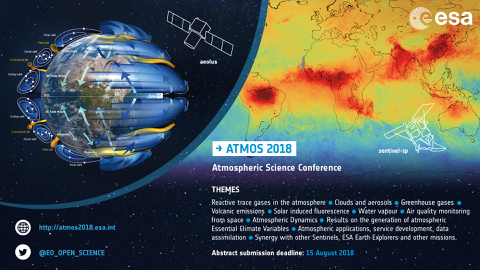
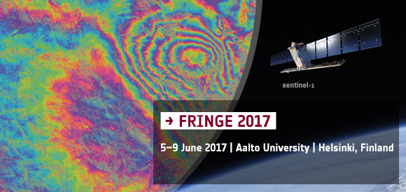
GI2.5 Sentinel 1 for Science, InSAR results. The Sentinel-1 mission is the European Imaging Radar Observatory for the Copernicus joint initiative of the European Commission (EC) and the European Space Agency (ESA). The S-1 mission includes a C-band imaging radar operating in four exclusive acquisition modes with different resolution (down to 5 m) and coverage (up to 400 km). It provides dual polarisation capability, very short revisit times and rapid product delivery. Synthetic Aperture Radar (SAR) has the advantage of imaging during day or night and under all weather conditions. The mission is composed of a constellation of two satellite units, S-1A and S-1B, sharing the same orbital plane and featuring a short repeat cycle of 6 days optimised for SAR interferometry science and applications. The pre-programmed operation mode of S-1 ensures avoidance of conflicts, building in the meanwhile a consistent long-term data archive most suitable for InSAR applications based on long time series. In particular, the main operational mode of S-1 over land, the Interferometric Wide swath (IW) mode, implemented using the Terrain Observation by Progressive Scans (TOPS) mode, provides large-scale mapping capability (swath width of 250 km) and high revisiting frequency, retaining ground resolution at 5x20m in range and azimuth, respectively. Following the launch of the S-1A in April 2014 and successful in-orbit commissioning phase completed in September 2014, the gradual release of the operationally qualified products to the science community via the ESA's Sentinels Scientific Data Hub has started since October 2014. The full operation capacity is foreseen after the in-orbit commissioning phase of the S-1B unit by end 2016. In this session, all scientists exploiting the main Sentinel modes (TOPS) for interferometry science and applications are cordially invited. The objective of the session is to present, demonstrate and discuss the state-of-the-art in scientific exploitation of S-1 TOPS interferometry and the potential for new applications and future services.
GI2.4 Scientific Exploitation of Copernicus Sentinels. Copernicus will provide accurate, up-to-date and globally available information on an operational basis for services and applications related to land, sea/ocean and atmospheric monitoring as well as to emergency response and security in support of European policies. On behalf of the European Union, the European Commission manages the overall programme and coordinates the Copernicus service component whereas the European Space Agency manages the Copernicus space component, and the European Environment Agency coordinates the Copernicus in-situ component. The Copernicus space component comprises, in addition to a range of contributing missions, new missions called the Sentinels which are under development since 2007. The new Sentinel missions will feature radar and super-spectral imaging as well as ocean and atmospheric monitoring capacities. The Sentinel missions are primarily designed to provide routine observations for operational services. However the Sentinel missions are also very attractive for performing state of the art scientific research and developing innovative applications. Furthermore, the uptake of the data by the science communities is essential for improving existing services and/or developing new services, and thus supporting the evolution of the overall system. The first Sentinel 1A imaging radar mission was launched successfully in April 2014 and following a successful in orbit commissioning the data are available to the science community since beginning of October 2014. The first Sentinel 2A land monitoring optical mission was launched successfully in June 2015. Sentinel 2A has completed its in orbit commissioning on 15 October 2015 and data have been opened to the science community via the science hub on 2nd December 2015. The first Sentinel 3A to deliver operational ocean and land observation is due to launch in early 2016 and in orbit commissioning is planned for a duration of 5 months. Sentinel 3A will be jointly operated by ESA and EUMETSAT. The session is intended to outline the status of the Copernicus system and to introduce scientific exploitation activities that complement operational Copernicus services.
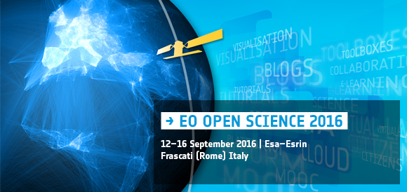
ESSI3.10 Tools and platforms for making remotely sense data easy to use to geoscientists. This is a new session specifically dedicated to EO Open Science. The Earth Observation and space community is now facing the challenge to respond to the abundance of Remote Sensing satellites (in particular the Sentinel fleet) and make this data more easy to use to the geoscientist. This session will provide an unique overview of some of the key-trends and impact of the current tools and platforms for transforming raw data coming from remote sensing satellites into useful products for data-intensive research in geosciences, applications and education.
ESSI3.8 Citizen-empowered science and crowdsourcing in the geosciences. Over the last decade, rapid advances in ICT, computing, communication technologies (e.g., smartphones and web 2.0 technologies), and a generally growing geo-literacy, have enabled non-specialists to participate in truly scientific endeavors. This so-called “Citizen Science”, as well as the related concepts of crowdsourcing and volunteered geographic information (VGI), support both fundamental research and societal applications, and come in many forms, such as observations of biodiversity, validation of remote sensing maps, or support of post-disaster response through smartphone-based provision of ground information or collective image-based damage mapping. In the geosciences Citizen Science has also seen a growing importance, e.g., in the creation of reference data sets, training of models, or validation of mapping results. Contrasting the vast potential such approaches hold are challenges related to data accuracy and validation, spatial bias, sustainability of citizen science projects, or the maximizing of synergy between novel crowd-based approaches and traditional methodologies. Recognizing the growing importance of Citizen Science as a new paradigm in research, and the unique opportunity it offers to tap into the enormous passion and good will of a wide community of citizens, papers are invited that highlight novel insights into the optimal use of citizen science approaches, their combination and integration with traditional methods, optimal and scientifically rigorous ways to train and steer a crowd contributing to a geoscience problem, communication aspects in citizen science, or the role these methods can play in education and in bringing science closer to society.
EO Summer School: big success!
14 August 2014
Young Earth scientists from all over the world have joined the two-week EO Summer School at ESA.s ESRIN in Frascati, Italy. The EO Summer School is supported by ESA.s Scientific Exploitation of Operational Missions (SEOM) element. Over 70 students . mostly PhD students and young postdoctoral scientists . from 23 countries attended daily lectures by 12 leading scientists. In the afternoons, the students were given practical computing exercises on the processing of Earth observation data with computer-based learning.
The students also presented their own work to the other participants in daily poster sessions each evening. At the closing session of the Summer School, awards from the European Meteorological Society were given out to the best posters. Winners included Delphine Leroux from CESBIO (France) for her poster on soil moisture retrieval from SMOS observations, and Jessica Daniele Flahaut from VU University Amsterdam (Netherlands) for her poster on remote sensing analysis of the Valles Marineris on Mars. Karolina Dominika Fieber from the University of Reading (UK) was also recognised for her poster on using airborne lidar for discontinuous vegetation canopy characterisation.
More at http://www.esa.int/Our_Activities/Observing_the_Earth/Summer_school_success
SENTINEL-2 for Science Workshop: record participation of the scientific community!
11 July 2014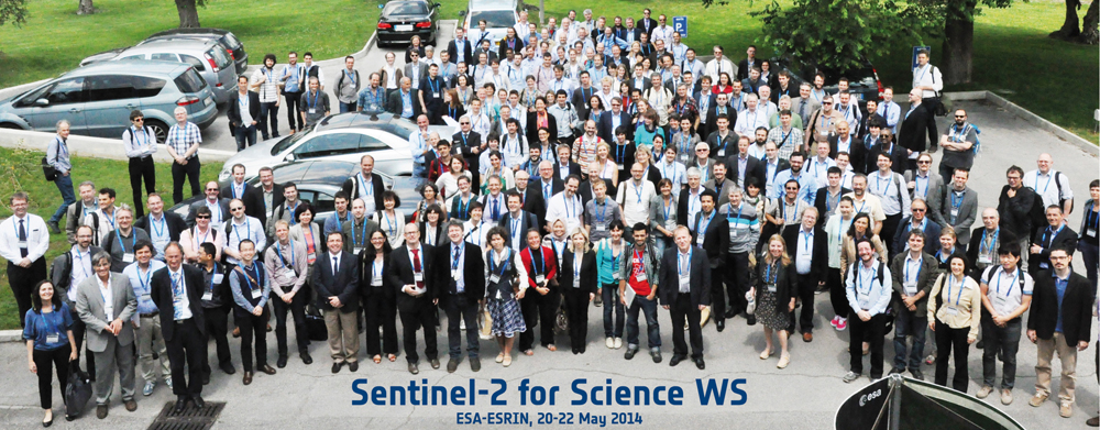
As part of the Scientific Exploitation of Operational Missions (SEOM) program element, scientists and users gathered in Italy to discuss the progress of the upcoming Sentinel-2 mission and its many applications. Over 400 attendees from 44 different countries convened at ESA’s ESRIN centre for Earth observation in Frascati, Italy, for the Sentinel-2 for Science workshop.
All presentations, participants list, session summaries and recommendations are available at http://seom.esa.int/S2forScience2014.
2nd ESA Advanced Training Course on Atmospheric remote Sensing
May 2014
As part of the Scientific Exploitation of Operational Missions (SEOM) program element, the European Space Agency (ESA) is organising an advanced Atmospheric Training Course, devoted to train the next generation of Earth Observation (EO) scientists to exploit data from ESA and operational EO Missions for science and applications development.The 5 day course will be held at the Forschungszentrum Jülich - Institute of Energy and Climate Research, Germany from 27-31 October 2014.
For further information please visit the website.
3rd ESA Advanced Course on Radar Polarimetry
20 March 2014
As part of the Scientific Exploitation of Operational Missions (SEOM) programme element, the European Space Agency (ESA) is organising the 3rd Advanced Course on Radar Polarimetry devoted to train the next generation of Earth Observation (EO) scientists to exploit dual and fully polarimetric data for science and applications development.
Post graduate, PhD students, post-doctoral research scientists and users from European countries and Canada interested in Radar Polarimetry and its applications are invited to apply to the 5 day course on the subject, which will be held in ESA ESRIN, Frascati, Italy on 19-23 January 2015.
Research scientists and students from all other countries are also welcome to apply and participate to the course subject to space availability.
For further information please visit the website.
POLinSAR 2015 and 1st BIOMASS Science Workshop
25 February 2014
The European Space Agency is jointly organising the 7th International Workshop on Science and Applications of SAR Polarimetry and Polarimetric Interferometry, POLinSAR 2015, and the 1st BIOMASS Science workshop.
The workshops will be held in ESA-ESRIN, Frascati, Italy on the following dates:
POLinSAR 2015: 26-30 January 2015
1st BIOMASS Science workshop: 27-30 January 2015
For further information please visit the workshop website.
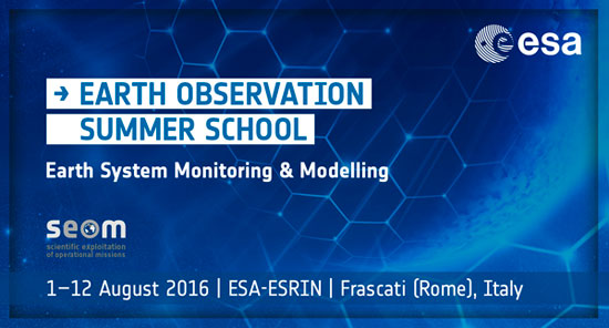
7th ESA EO Summer School
The European Space Agency (ESA) is pleased to announce the 7th EO Summer School on "Earth System Monitoring & Modelling". This two-week course will be held in ESA/ESRIN (near Rome, Italy) from 4-14 August 2014 and aims to provide students with an integrated end-to-end perspective going from measurement techniques to end-user applications. Courses include lectures covering issues related to Remote Sensing, Earth System Modelling and Data Assimilation as well as hands-on computing exercises on the processing of EO data.
The school is open to Early Career Scientists (Ph.D. students, young post-doctoral scientists) who are specialised in a variety of Earth Science disciplines and wish to expand and improve their knowledge and skills. Participation is limited to a maximum of 60 students.
Students must apply using the on-line application form which is now available at: https://earth.esa.int/web/eo-summer-school/application-submission
The deadlines are as follows:-
Application: 7/3/2014
Reference Letter Submission: 14/3/2014
All enquiries should be addressed to eotraining@esa.int
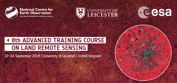
5th ESA Advanced Training Course on Land Remote Sensing: application submission open
20 January 2014Post graduate, PhD students, post. doctoral research scientists and users from European countries and Canada wishing to participate can apply on-line via the training course website. Research scientists and students from all other countries are also welcome to apply and participate to the course subject to space availability.
Participation is limited to a maximum of 70 students and is subject to a selection of application.
No participation fees will be charged for the training but participants are expected to cover their own travel and accommodation expenses (financial support is not available).
Application submission deadline: 7 May 2014.
For further information please visit the LCT2014 website.
5th ESA Advanced Training Course on Land Remote Sensing
9 December 2013As part of the Scientific Exploitation of Operational Missions (SEOM) programme element, the European Space Agency (ESA) organises each year an advanced Land Training Course devoted to train the next generation of Earth Observation (EO) scientists to exploit data from ESA and operational EO Missions for science and applications development.
Post graduate, PhD students, post. doctoral research scientists and users from European countries and Canada interested in Land Remote Sensing and its applications are invited to apply the 5 day course on the subject, which will be held at the University of Valencia, Valencia, Spain on 8-12 September 2014.
SENTINEL-2 for Science Workshop
11 November 2013The European Space Agency, in the context of the Scientific Exploitation of Operational Missions (SEOM) element, is organising an event dedicated to prepare for scientific exploitation of the Sentinel-2 mission, entitled "Sentinel-2 for Science Workshop", which will be hosted in ESA-ESRIN, Frascati, Italy, on the 20th, 21st and 22nd May 2014.

Getting ready for ESA's 3rd Advanced Training on Ocean Remote Sensing
2 September 2013To train the next generation of Earth Observation (EO) scientists to exploit data from ESA and operational EO Missions for science and applications development ESA is organising under the Scientific Exploitation of Operational Missions (SEOM) element a series of advanced thematic training courses. The next training course will be on ocean remote sensing and will be held in Cork, in the National Maritime College of Ireland from 23 to 27 September 2013.
In total 50 post graduate, PhD students, post-doctoral research scientists and users from European and a few non-European countries have been selected to take part in this 5-day course. Students will be taught in a variety of subjects including theoretical fundamentals of optical, thermal and SAR ocean remote sensing, processing algorithms, data products and their use in applications in open oceans and costal zones. The course will include formal lectures by leading scientists as well as hands-on computing exercises allowing students to use existing software tools (BEAM, BRAT, SARTool, Bilko) for the interpretation of signatures from SAR, Optical/Thermal and Radar Altimeter data and their transformation into geo-physical products.
After the training week also the course material will be available on line.
For further information please visit the OCT2013 website.

4th Advanced Training Course in Land Remote Sensing material available on line
2 September 2013The training course includes formal lectures by leading scientists as well as hands-on computing exercises exposing students to both SAR and Optical/Thermal land remote sensing. The practicals focus on the exploitation of EO data from the ERS, Envisat, Explorers, TPM and national missions as well as simulation data from the upcoming ESA's Sentinels.
Download the Training Course material
 |
 |
Advanced Land Remote Sensing course for next generation scientists
3 July 2013ESA's series of advanced training courses brings every year world-renowned remote-sensing experts and PhD students together to ensure tomorrow.s scientists are able to make the most of the Earth Observation data available for scientific research and applications.

ESA SEOM Land Training course participants at Harokopio University, Athens July 1st 2013 (copyright ESA)
More than 70 students from 31 countries gathered from 1 to 5th July 2013 at the HAROKOPIO Universityin Athens Greece to attend a week-long advanced training course devoted to exploit ESA Earth Observation remote sensing data for land applications, such as forestry, fires, floods and water availability.
The course organized under the ESA Scientific Exploitation of Operational Missions (SEOM) program element, introduced students to remote sensing science ,applications and illustrated the use of specific software tools for scientific exploitation of Earth Observation (EO) data from ESA.s and Third Party operational missions. A selection of lectures are being streamed on the ESA portal during the week to follow the training remotely. (https://earth.esa.int/web/guest/landtrainingcourse2013/webstreaming)

ESA SEOM Land Training Course plenary ,Harokopio University , Athens, July 1st 2013 (copyright ESA)
Prof. Isaac Parcharidis local organizer for the training course said: "Initially I would like to thank ESA to choose our University for organizing the seminar. Education through the seminars of this type enables young scientists to come into contact with advanced Earth Observation scientific issues and discuss with colleagues from different institutions of Europe. From a similar seminar, titled "from optical to radar", held in 90's at ESRIN began my scientific journey with SAR data and interferometry".
The course had a particular focus on the theoretical concepts of radar, optical and thermal sensors. Accounting for the different remote sensing backgrounds of the students, the fundamentals of the course were presented in parallel sessions covering both basics and advanced concepts in each field.
Dr Kostas Papathanassiou from the German Aerospace Center stated "The new generation of scientists are highly interested and well informed about the new ways in SAR remote sensing opened by the upcoming new generation of European and international SAR missions." He added "The Environmental and mapping applications reflected most of the questions and interest. The level of students is improving from year to year."

The main applications of land remote sensing, which were addressed through keynote lectures and dedicated hands-on sessions, included land cover and land use classification techniques, forest and crop mapping, forest fire detection and drought monitoring. Advanced techniques such as SAR Interferometry, used for detecting very slight volcanic or tectonic land motion, and SAR Polarimetry, employed to add multi-polarised 'colour' to radar images for enhanced land-cover mapping, were also covered.
Getting Ready for the SEOM Advanced Training Course in Land Remote Sensing
28 June 2013The European Space Agency (ESA) is organising under the SEOM element a 5 day course which will be held in Harokopio University, Athens, Greece from 01 to 05 July 2013.The objective is to train the next generation of Earth Observation (EO) scientists to exploit data from ESA and Third Party EO Missions for science and applications development.
More than 220 applications have been received and 73 students from 31 countries have been selected to take part to LTC 2013. To allow students not selected to follow the week long training, a Web streaming of the Course.s lectures will be broadcasted. After the Training week also the Course material will be available on line.
For further information please visit the LTC website.
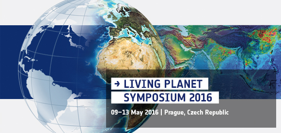
Getting ready for ESA's largest scientific event of the year
10 June 2013Start planning your week in Edinburgh . the programme for September.s Living Planet Symposium is now available online.
Organised and hosted by ESA with the support of the UK Space Agency, the event on 9.13 September in Edinburgh, UK brings together scientists and users to present their latest findings on Earth.s environment and climate derived from satellite data.
The programme outlines over 1700 presentations during nine daily parallel sessions and three poster sessions.
Grants from ESA and the EU will financially support the attendance of over 100 European students at the symposium.
3rd Advanced Training Course on Ocean Remote Sensing
23-27 September 2013As part of the Scientific Exploitation of Operational Missions (SEOM) programme element the European Space Agency (ESA) is organising a series of advanced thematic training courses devoted to train the next generation of Earth Observation (EO) scientists to use data from ESA and operational EO Missions for science and applications development. Post-doctoral and graduate research scientists, PhD students and EO information users from European countries and Canada interested in ocean remote sensing and its applications are invited to attend a 5 day course which will be held in Cork, at the National Maritime College of Ireland from 23 to 27 September 2013.
Research scientists and students from non-ESA member countries are also welcome to apply and participate in the course subject to space availability.
Application submission deadline: 31 May 2013
POLINSAR 2013: Keeping carbon stocks in check
5 February 2013Satellite radar data are being used to map Earth's vital resources. The latest advances and applications of the POLinSAR remote sensing technique were highlighted at a conference held last week.
SEOM Synthetic Aperture Radar Polarimetry course
28 January 2013Within the framework of the new ESA Scientific Exploitation of Operational Missions (SEOM) element of the Earth Observation Envelope Programme 4, a one week course has been organized on scientific exploitation of Synthetic Aperture Radar(SAR) Polarimetry imagery at ESA-ESRIN establishment in Frascati, Italy.
2nd Advanced Course on Radar Polarimetry
21 - 25 January 2013The European Space Agency is organising under the SEOM element, the 2nd Advanced Course on Radar Polarimetry which will be held in ESA/ESRIN, Frascati, Italy.
The course will provide a substantial and balanced introduction to the basics and advanced concepts of theory, scattering concepts, systems and applications typical of radar polarimetric remote sensing, as well as hands-on computing exercises on PolSAR and Pol-InSAR data processing for remote sensing applications. Some 65 participants originating from 26 countries are registered for the week long training course.
The training preliminary programme is now online
POLinSAR 2013
28 January - 01 February 2013The European Space Agency is organising under the SEOM element ,the 6th International Workshop on Science and Applications of SAR Polarimetry and Polarimetric Interferometry, POLinSAR 2013, will be hosted in ESRIN, Frascati, Italy. The aim of the workshop is to provide a forum for scientific exchange to present results and progress in the fields of SAR Polarimetry and Polarimetric Interferometry. The Symposium is open to ESA Principal Investigators, scientists, students, future SAR missions users, representatives from space agencies and value adding industries.
The workshop preliminary programme is now online
4th Advanced Training Course in Land Remote Sensing
01 - 05 July 2013The European Space Agency (ESA) is organising under the SEOM element a series of advanced thematic training courses devoted to train the next generation of Earth Observation (EO) scientists to exploit data from ESA and Third Party EO Missions for science and applications development.
Post graduate, PhD students, post-doctoral research scientists and users from European countries and Canada interested in land remote sensing and its applications are invited to attend a 5 day course which will be held in Harokopio University, Athens, Greece from 01 to 05 July 2013.
Application submission deadline: 28 February 2013
ESA Living Planet Symposium 2013
09 - 13 September 2013The 2013 European Space Agency Living Planet Symposium follows the previous successful symposia held in Bergen (2010), Montreux (2007) and Salzburg (2004). The event will be held in Edinburgh, United Kingdom from 09 - 13 September 2013 and is organised with the support of the UK Space Agency.
The aim of the Symposium is to present the results of ESA EO missions exploitation by providing a forum for investigators to report and discuss results of on-going science activities.
Abstract submission deadline: 15 February 2013